01The depot that became the capital
Nairobi begins with an engineering problem. In 1899 the Uganda Railway reached the swampy flat at the foot of the Kikuyu escarpment and could go no further without reorganising for the climb into the Rift. A depot was pitched on the flat to service the works: sheds, a stores yard, a water point and a line of rail. That depot is the whole reason a city stands here. There was no harbour, no mine, no existing settlement of consequence. There was a gradient, and the railway needed somewhere to gather strength before it tackled it.
The railway company then did what railway companies did across the empire: it laid out a grid beside the depot and sold plots. The town that grew was a service town, and everything the city later became sits on top of that fact. The commercial spine was drawn running west from the depot, the market streets went in a block north, and the administrative offices were placed on the higher ground. Hold that arrangement in mind and the modern centre stops looking arbitrary. The banks, the market and the government quarter are where they are because the railway put them there in the 1890s.
The scale is worth pausing on. The site was chosen for temporary convenience, not permanence, and the engineering staff expected it to be a staging post. The swamp was regarded as a drawback, and the flat was regarded as unhealthy. What changed the calculation was the depot itself: once the workshops and the stores were established, labour followed, traders followed the labour, and the administration followed the traders. By the time the railway was through the Rift the town had a reason to exist that no longer depended on the gradient. This is the ordinary way cities are made, and it is worth seeing plainly without romance.
The verdict for a visitor is simple. The railway quarter explains the centre better than any other part of it, and the explanation is structural rather than nostalgic. You do not need a guided tour or a plaque to read it. Stand at the origin of the grid and look south: the land falls away to the yards and the station, and it is obvious which way the city grew and why. Treat the founding date, 1899, as the single fact to carry, and treat everything downstream of it as engineering that produced a capital by accident.
02The founding, and the grid it drew
The dates the handoff publishes are few, and the value of this page is in refusing to embroider them. The railway reaches the site in 1899 and the depot that becomes Nairobi is established. Work on the line continues in stages through the following years, and the town is laid out on a grid beside the depot and the yards. The present station building opens in 1929 at the foot of that grid. The Railway Museum opens in 1971 in the yard beside the station. In 2017 standard gauge services begin from a new terminus outside the city, and the old station is left with commuter traffic. Those are the fixed points.
What the grid drew is more useful to a reader than the chronology. The commercial street runs west from the depot and carries the banks; the market and the wholesale streets sit a block north of it; the administrative buildings occupy the higher ground to the south and east; and the railway land itself forms the southern boundary of the centre. Every quarter of the CBD is positioned by its relationship to the yards. The avenue is the spine because it was surveyed first and widest. The market quarter is north because that is where goods could be moved and stored. The civic square is south because that is where the colonial administration wanted to be seen.
The depot's second life is the part most visitors miss. Once the workshops were established, the railway became the largest employer in the centre, and the land around the yards carried sheds, housing and stores that were never planned as a townscape. That industrial belt is the reason the southern edge of the CBD feels wider, emptier and less tidy than the rest of the grid. It also explains the gap that opened after 2017, when long-distance passenger traffic moved out to the new terminus and left the old station handling the commuter network. Land that existed to serve a station no longer serving that traffic is the clearest physical record of the change.
The verdict on the substance is that the grid is the exhibit. Read the city as a plan drawn to serve a depot and the whole centre becomes legible in an afternoon. Read it as a collection of buildings and it stays a scatter of dates. If a single walk is to be made, make it from the origin of the grid downhill towards the station and the museum, then turn round and look back up. The slope, the width of the avenue and the position of the yards will do the explaining that no caption can. The dates matter less than the direction of the fall.
The 1899 depot
The Uganda Railway reached this flat in 1899 and stopped to gather strength for the climb into the Rift. The depot pitched to service the works became a town, then a capital.
The 1929 station
The station building at the foot of the grid opened in 1929 and still handles commuter services. The intercity standard gauge line runs from a terminus outside the city.
The grid above
The commercial grid was laid out beside the railway land, oriented to serve it. Kenyatta Avenue at Moi Avenue is the point from which the quarters are measured.
The museum
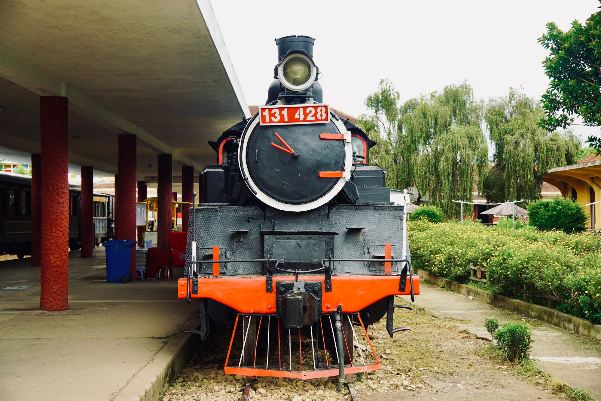
The Railway Museum opened in 1971 in the yard beside the station, with locomotives in the open and carriages to climb into. It is the best explanation of why the city is here.
03What this page cannot tell you
This page is compiled from published information and the site's own checks. It is not written from a visit, and no part of it claims one. Opening arrangements, ticketing, market days, services and anything else that moves week to week are set by the operator and are not printed here. Where a reader needs one of those facts, the honest answer is to get it from the operator directly on the day rather than from any page, including this one. The bullet list above sets out the specific things to confirm before travelling, and those four points cover most of what can go wrong.
The largest single trap is the station itself. Two different railway facilities serve Nairobi, and they are not interchangeable. The standard gauge service to Mombasa leaves from a terminus outside the city rather than from the 1929 station at the foot of the grid, so a ticket naming one will not get you onto a train at the other. Confirm which station your ticket names before you leave for the railway quarter at all. This is the kind of error that is easy to make and expensive to fix, and no amount of local knowledge substitutes for reading the ticket.
The second trap is the walking environment. The yards and the approach roads are working industrial land, unlit in stretches and empty once the working day ends. Daylight is the sensible window, and a car is the sensible way back if the light has gone while you are still down there. The third is the museum's own arrangements. It keeps its own hours, closes in the mid-afternoon, and sets its own ticketing. Those arrangements belong to the museum and are subject to change, so confirm them on the day you intend to go rather than planning around a figure printed anywhere.
The honest caveat is therefore about the limits of the format, not the quality of the sources. A page that prints no clock time and no price cannot describe a day out completely, and it should not pretend otherwise. What it can do is give the fixed dates, the shape of the grid and the things to check, and leave the variable parts to the people who set them. The commuter services from the old station run to a timetable the operator sets, so read the current timetable rather than a guide. A guide, by definition, was written before the timetable changed.
- Check which station your ticket names before travelling: the standard gauge service to Mombasa leaves from a terminus outside the city, not the 1929 station.
- Keep to daylight on the approach roads and the yards, which are industrial, unlit in stretches and empty once the working day ends.
- Read the current Kenya Railways timetable rather than any guide, because commuter services from this station run to a timetable the operator sets.
- Treat the museum's opening hours and ticketing as the museum's to set and subject to change, and confirm them on the day you intend to go.
What this page does not print
Opening hours, ticket arrangements and market days are set by the operator and change. This site prints no price of any kind and no clock time, so none appear here. The museum keeps its own hours and closes in the mid-afternoon, but the arrangement belongs to the museum. Confirm the day and the ticketing directly with the operator before you set out, rather than trusting any page, including this one.
04What to do with the railway quarter
Treat the railway quarter as the first thing to do in the centre rather than the last. It is the least tidy part of the CBD and the most explanatory, and a reader who understands it on day one will read every other quarter more accurately afterwards. The practical shape is a morning downhill from the grid, the museum at the centre of it, and a return to the avenue before the light goes. The museum sits beside the station and closes in the mid-afternoon, which sets a natural end to the outing and a natural departure time back up the hill.
Pair it with the memorial park at the top of the quarter on Haile Selassie Avenue. That pairing makes a morning rather than an hour, and the two sit within a short downhill walk of each other on the same boundary of the centre. Both are ticketed in their own way and both set their own arrangements, so confirm the day and the ticketing with each operator before setting out. Beyond that, the quarter asks very little of a visitor. There is no circuit to follow and no prescribed route, only the slope and the rail land and a museum of locomotives that has been left unrestored on purpose.
Eat back up the hill. The railway quarter is working land and the food follows the shift pattern: kiosks near the station in the morning and at lunch, very little afterwards. The busy grid is a short walk north and feeds the whole city in the middle of the day, so plan to eat there rather than down here. The same applies to sleeping. There is almost no visitor stock in the railway quarter itself, and the sensible beds are on the avenue a short walk north, which is where anyone doing a museum morning should be based.
The verdict is that the railway quarter repays a half day and no more, and it repays it best on the way to somewhere else. It is not the centre's most comfortable ground and it is not trying to be. It is the reason the rest of the centre exists, and the single most useful thing a first visitor can do with an hour in the city is to stand at the top of it, look down at the yards, and understand that the capital was an engineering decision. Everything else in the CBD follows from that, and nothing else explains it as directly.
Where this page comes from
Desk research, not fieldwork. Nobody writing this stood on the corner with a stopwatch, and a page that implied otherwise would be the least trustworthy thing on the site. The specifics above came from here:
- Distances: computed from published coordinates, direct line from Kenyatta Avenue at Moi Avenue.
- Nairobi Railway Museum: Kenya Railways, museum information.
- Commuter rail services: Kenya Railways published timetables.
Opening hours, ticketing and market days change. No hotel or operator pays to appear here.
05Questions
Why does Nairobi exist at all?+
The Uganda Railway reached this swampy flat in 1899 and stopped to gather strength for the climb into the Rift. The depot pitched to service the works became a town, and later a capital. The whole commercial grid above was laid out to serve that railway land.
Can I catch the train to Mombasa from the old station?+
No. The standard gauge service to Mombasa leaves from a terminus outside the city. The 1929 station building handles commuter services on a timetable Kenya Railways sets. Check which station your ticket names before you travel.
Is the railway quarter walkable?+
The main approaches are fine on foot in daylight, and the station sits ten minutes downhill from Kenyatta Avenue. The yards and workshops roads are industrial land, unlit in stretches and empty after the working day. Keep to daylight, and take a car if you are late.
What is at the Railway Museum?+
Locomotives in the open, carriages you can climb into, and the coach tied to the Tsavo man-eater story. It opened in 1971 in the yard beside the station and is unrestored and dusty. An hour is enough, and the museum keeps its own hours.