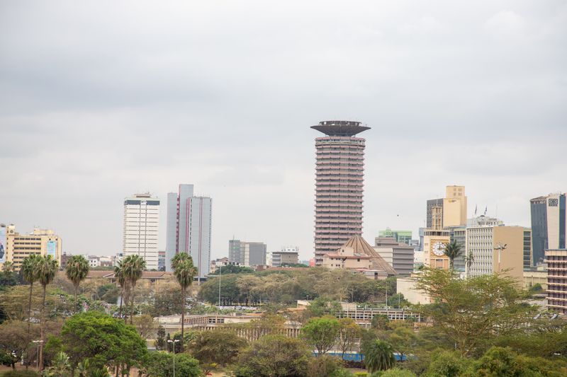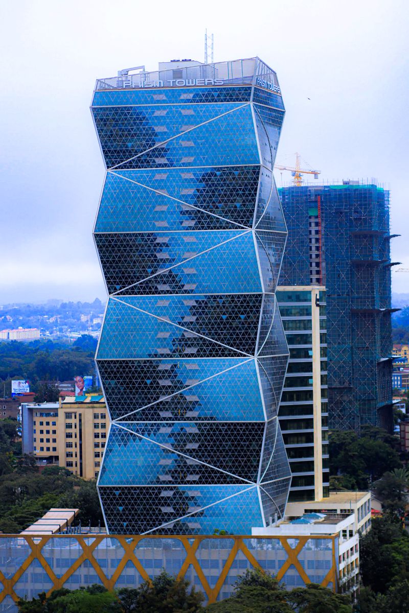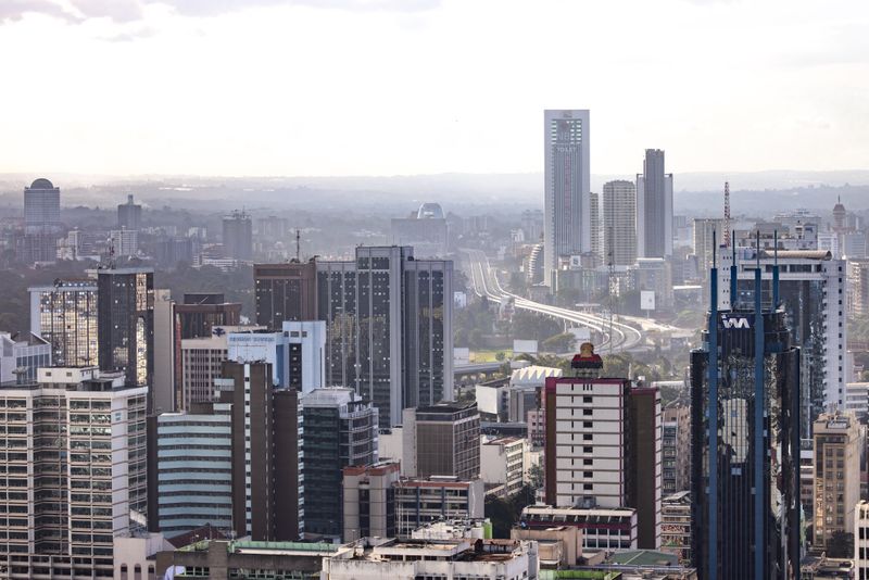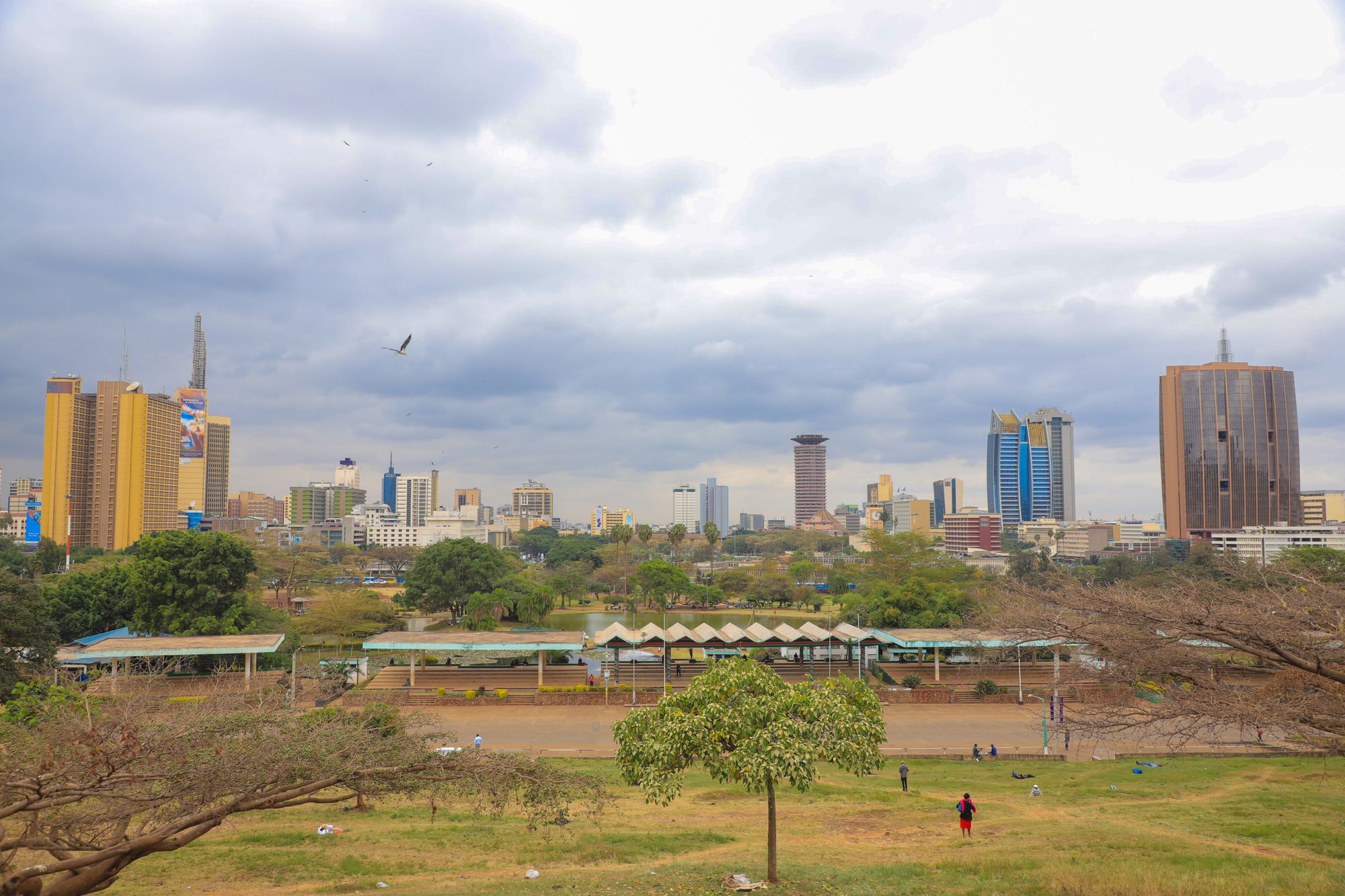
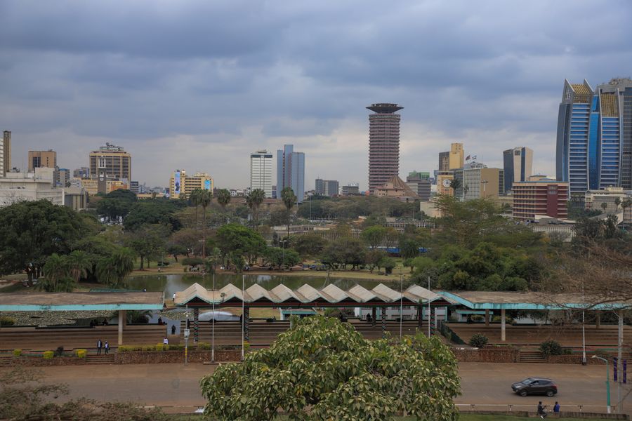
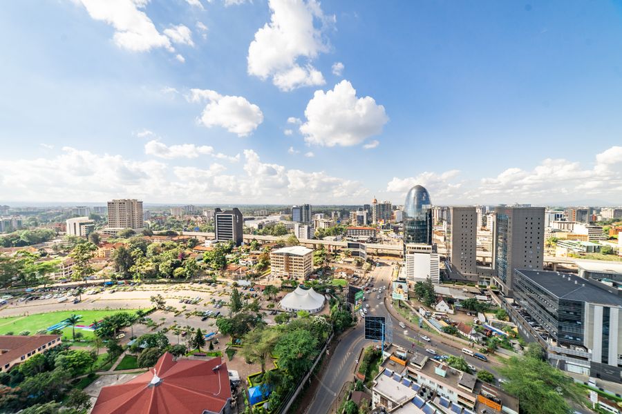
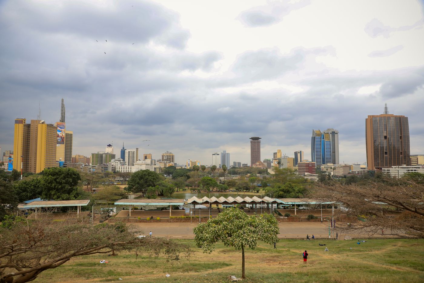
Uhuru Park and Central Park sit together along Uhuru Highway on the western edge of the grid, and they are the reason the CBD has a skyline photograph at all. Lawns, a boating lake, paved walks, and the towers standing straight up behind them.
The parks are also political ground. Freedom Corner, at the Uhuru Park end, is where the pro-democracy campaigns of the 1990s were held and where the city still gathers when it has something to say. The park was saved from development by that campaign, which is worth knowing while walking it.
01Why base here
- The clearest view of the Nairobi skyline anywhere, and the best light on it in the late afternoon.
- The only proper walk in the centre: grass, shade and a lake, five minutes from the banks.
- Central Park, the Nyayo monument and Freedom Corner are all in one loop.
- A straight walk east into City Square and the KICC.
02The longer view
Uhuru Park and Central Park are the lungs of the grid and the reason the skyline photographs as well as it does. They were laid out on the western edge of the centre where the ground falls away towards Uhuru Highway, and the artificial lake at the Uhuru Park end gives the towers something to stand in. The parks are the only proper walking in the centre that is not a pavement.
They are also the most politically loaded ground in the city. Freedom Corner, at the north end, is where the mothers of political prisoners held their hunger strike in 1992, and where the campaign that stopped a sixty storey tower being built on the park itself was fought at the end of the 1980s. A park that had to be defended is a different kind of public space from one that was simply provided, and the city treats it accordingly.
03The streets
The lake walk
Paved, level, and busiest at weekends when the boats and the photographers are out. The skyline sits directly behind the water from the eastern bank.
Freedom Corner
The northern end of Uhuru Park, a small grove and a plaque. The gathering point of the 1990s campaigns and still the city’s protest ground.
Central Park
Across the road to the north, quieter, with the older trees and the Nyayo monument.
The Uhuru Highway edge
Six lanes of traffic and the footbridges over it. The bridges are the only sensible way across.
04What to walk to
The boating lake
Boats for hire at weekends, and the best skyline view from the far bank. Busiest on Sunday afternoons.
Freedom Corner
Free, open and unmarked beyond a plaque. Read the history before walking through it.
The Nyayo monument
In Central Park, and the older of the two parks’ set pieces.
The KICC view line
From the eastern paths the conference tower, the basilica and the bank towers line up. This is the photograph.
05One walk through the quarter
The one walk in the centre where the surface is grass. An hour before sunset is the light; the gates close at dusk and that is enforced.
- 01 In from the Kenyatta Avenue end Five minutes west of the avenue, which is the easiest approach on foot and avoids crossing Uhuru Highway.
- 02 Along the lake edge The boating lake, the towers standing straight up behind it, and the clearest skyline view in the city. This is the photograph.
- 03 Freedom Corner The north end, and the ground the park’s political history sits on. There is a memorial and there is usually somebody gathered.
- 04 South into Central Park Quieter, more planted, and the connection through to the Nyayo monument and the highway edge.
- 05 Out before dusk The gates close with the light. At the equator that happens fast and at roughly the same time all year.
06How far everything else is
Direct lines from Uhuru Park to the rest of the grid, computed from published coordinates at 4.8 km/h. They are a floor: pavements, crossings and the hour of the day all add to them.
07A short history, in four dates
08Staying here
The hotels facing the park are among the best-reviewed in the centre: garden frontage, high service ratings and the skyline on one side with lawns on the other. Reviews consistently rate them highest in the CBD on grounds and on quiet, which is exactly what the park buys.
No rates on this page
Nightly figures go out of date faster than a page can be rewritten, so this site does not print them. Ratings, review counts and whether a place is walkable to what you came for are the comparison layer. Live availability sits with the booking partner.
09Eating here
Inside the park
Kiosks and stalls around the paths serve snacks and soft drinks, and they follow the park’s daylight hours.
The hotel side
The blocks between the park and the avenue hold the older full-service hotels, which is where an actual meal is, five minutes back east.
10Practical
Getting here
On foot from Kenyatta Avenue in about five minutes. Use the footbridges to cross Uhuru Highway; six lanes with no gaps is not a crossing.
On foot
Paths, grass and gentle slope. The only quarter on this site where the walking is recreational rather than functional.
Hours
Daylight, closing at dusk. The boating operation and any event use of the park are set by the county and change.
What changes
Rebuilt sections, event closures and the boating arrangement all move. The closing-at-dusk rule does not.
11After the offices empty
The parks close at dusk and that is enforced. After dark the whole western edge is a traffic corridor rather than a place: the hotels are fine, the footbridges are not. Walk the parks in the last two hours of light and then go inside.
12What people get wrong
Crossing Uhuru Highway on foot at grade
Use the footbridges. Six lanes with no gaps is not a crossing.
Leaving the park photograph until dusk
The light goes fast at the equator and the gates close with it. Aim for the hour before sunset, not the moment of it.
Going for the sunset itself
The light goes quickly at this latitude and the gates go with it. Aim for the hour before, not the moment.
13Things to do in this area
14Where this page comes from
This page is desk research, not fieldwork. Nobody from this site is claiming to have stood on the corner and timed the walk for you. What follows is where the specifics came from, so you can check any of them.
- Uhuru Park: Nairobi City County park information and the reopening notices.
- Freedom Corner and the Green Belt Movement campaign: Green Belt Movement, published history.
- Distances: computed from published coordinates.
- Uhuru Park: Nairobi City County park information and the published record of the 1989 campaign.
- Freedom Corner: the public record of the 1992 hunger strike.
Opening hours, ticket arrangements and market days change. Where this page cannot know a current figure it says so instead of printing one. No hotel, operator or agency pays to appear on it.
15Questions
Is Uhuru Park open after its rebuild?+
Yes, the park reopened after a long refurbishment and is busy again at weekends. Opening hours and any works are posted at the gates, which is the place to check for your date.
Is it safe to walk in the park?+
In daylight, and with other people around, it is the pleasantest walking in the centre. It closes at dusk and should not be in anyone’s evening plan.
Where is the best skyline photograph?+
From the eastern bank of the boating lake in the late afternoon, with the towers behind the water. The KICC lines up from the paths nearer the highway.
Can I walk from here to the National Museum?+
Yes, north along the park edge and up Museum Hill, though the road crossing at the Globe is the awkward part. It is a reasonable walk in daylight and an unreasonable one after dark.
Is Uhuru Park open again after the works?+
It reopened after a long rebuild of the paths, planting and lake edge. Sections have closed and reopened in phases since, so check the county’s current notice rather than assume the whole park is accessible on the day.
Can I walk from the park to the centre?+
Yes, and it is the intended approach: five minutes east puts you on Kenyatta Avenue. Do not attempt Uhuru Highway on foot at grade; the footbridges exist for a reason.
Is there a charge to enter the park?+
The parks are public open space and entry is free. Boating on the lake and any event or filming use are operated separately and carry their own arrangements, which are the county’s to set and change.
Why does the park matter politically?+
Because it had to be defended. A tower complex was planned on it at the end of the 1980s and stopped by a public campaign, and the north end of the park was the site of the 1992 hunger strike by mothers of political prisoners. A city park that survived both is public space in a stronger sense than one that was simply provided.