01Why the grid still asks the first question
The question this guide settles is why Nairobi's central business district still looks and works the way it does. The answer is that the centre is one grid, laid out beside a railway depot in 1899 and never rebuilt. The streets between Uhuru Highway, the railway and Ngara have kept their alignment through every change since, so the shape of the town in 1899 is the shape of the centre now. Understanding that saves you from treating the district as a collection of separate places. It is one decision, made once, still standing.
That grid was not designed to be a capital. It was a depot and a bazaar on swampy ground, laid out on a north-south axis from the station because the railway was the only reason for being there. The avenue widths reflect ox spans and turning circles, not motor traffic. When the town became the capital and then a city, the plan was stretched rather than replaced. So the centre carries its origin in its proportions, and a walk down Kenyatta Avenue reads differently once you know the street is wider than the traffic and always was.
Why this is the first question, rather than a curiosity, is that every other thing the district does follows from the grid. The civic square sits at the top of the avenue because that is where the colonial administration put itself. The market quarter sits where the Indian commercial town grew beside the railway. The offices that have left for the ridge left from a grid that cannot expand its plot sizes. Ask the shape first, and the rest of the centre stops looking arbitrary.
02The quarters, compared by what they explain
The quarters are not equal in what they teach. Compare them by the question each one answers about the centre, and the walk organises itself. Use the row list below as the order of comparison, not as a route. Some quarters explain the original decision, others explain the drift that came after it, and at least one explains what the centre still does for the country every morning before the offices open.
Kenyatta Avenue and the civic square explain the colonial plan at its grandest: a spine, a set of institutions facing open paving, and the tower that became the city's shorthand. Moi Avenue and the Archives explain the commercial town at full volume, where offices stack above subdivided ground floors and the archive sits in a former banking hall. Biashara Street and City Market explain the older retail town, the one-family-wide shops, the cloth trade and the art deco market hall. The Railway Quarter explains the reason any of it exists: the depot, the 1929 station and the museum that nobody has tidied. Read those four in that order and the grid tells its own story.
The point of the comparison is that these four carry different weights. Two are about the plan, one is about the trade that filled the plan, and one is about the origin that made the plan necessary. A visitor who goes only to the avenue gets the frontage without the reason. A visitor who goes only to the Railway Quarter gets the reason without the city that grew on it. The row list is the shortest complete answer, and the order matters more than the count.
Kenyatta Avenue and the civic square
Six lanes with a planted median, then the open paving of City Square and the KICC tower. This pair explains the colonial layout and the post-independence skyline in one half day, and both are best in daylight.
Moi Avenue and the Archives
The loudest pavements in the country, with the National Archives in a former banking hall at the middle. Street life, errands and the clearest view of how the centre actually trades.
Biashara Street and City Market
Bazaar Street kept its family-wide shops, its cloth and the 1930s market hall. The densest architectural history per hundred metres in the grid, and the most shaded walking.
The Railway Quarter and Muthurwa
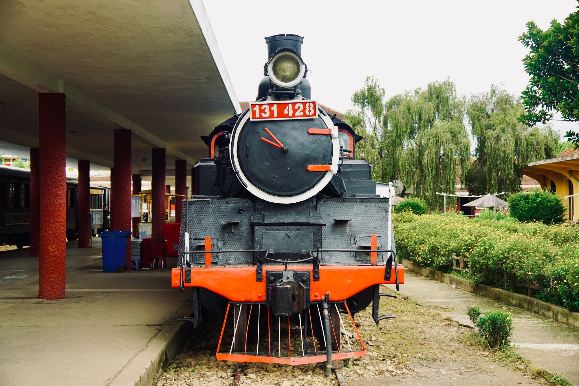
The depot that caused the city, the 1929 station and the museum beside it, with the wholesale market and termini pushing east. Understand this edge and the whole layout follows.
03The mistake readers make about the centre
The mistake is to treat the drift of offices west as a decline, and then to skip the centre because it is supposedly finished. The drift is real. Since the 2000s corporate tenants have moved to the Upper Hill ridge and beyond, and the ground floors they left behind have refilled with retail. But a grid that loses head offices is not a grid that loses its function. It loses one function and takes on another. The centre still holds the courts, the archives, the markets, the transport stages and the civic square.
A second version of the mistake is to read the empty upper floors of the avenue as evidence that the district is dangerous or abandoned. They are neither. The pavements of Moi Avenue and Tom Mboya Street carry more pedestrians than anywhere else in the country, and the market quarter still trades cloth by the metre. What has changed is who occupies which floor, not whether the street is used. The gap between the grandeur of the avenue and what now trades on its ground floors is the most honest thing about the quarter, and it is not a warning.
The third version is to assume the centre is only worth a stop on the way to somewhere else. That produces a rushed visit to the civic square and a photo of the tower, and it misses the part that explains the rest. The Railway Quarter is ten minutes downhill from the avenue and holds the origin of the whole layout. The market quarter is a short walk east and holds the architecture the malls replaced. The centre is not a leftover. It is the thing the ridge was built to escape, and it still does more kinds of work than the ridge does.
04How to walk it, and what is not known
Practically, the centre rewards a single day on foot, ordered from the avenue downhill to the railway, with the market quarter inserted between them. Start early, while the pavements are shaded and the stages are still moving. Do the civic square while the light is behind the tower. Break in the market quarter when the heat is at its worst. Finish at the Railway Quarter. The bullet list below turns that order into rules you can keep, and the rules are about timing and transport rather than about any single sight.
This page is compiled from published information and the site's own checks rather than from a visit by anyone writing here. That matters for what follows. Opening arrangements and anything that moves week to week are not printed here, because they are set by the operators and they change. Museum and archive times, whether the tower deck is open, which market hall is trading, and which terminu... which stage serves which route are all things to confirm with the operator on the day. The callout below carries the one date this page cannot settle: when, or whether, the office drift ends.
What is known is the shape. The grid has held since 1899, the avenue since the colonial survey, the civic block since the 1930s and the tower since 1973. The Railway Quarter has held since 1899 with the station added in 1929. Those are settled. What is not settled is the current state of any given door. So plan the route by shape and the day by what is confirmed locally. That division is the whole method: trust the street plan, verify the opening, and do not print a figure for something that moves.
- Walk the avenue first, before the offices empty and the pavements lose their shade.
- Agree the fare before you get into any car, and take a car rather than walk after dark.
- Carry no more cash or phone than the day needs, and keep neither in a hand held loosely.
- Check the museum, archive and tower deck arrangements with the operator, because they move with the season.
- Cross Ngara and Muthurwa by car in the middle of the day rather than on foot at either end of it.
The date the page cannot settle
No figure for when the office drift ends is printed here, because none exists. Commercial tenants have been leaving the grid for the ridge since the 2000s and the ground floors have refilled with retail, but whether the centre keeps emptying or fills again is a live question. Published commercial property research is the thing to read, and it changes.
05The verdict, and when to ignore it
The verdict is that the CBD in a hundred years is the same CBD in a hundred years, and that is the point. A visitor who wants to understand Nairobi should walk the grid before the ridge, because the grid is the decision and the ridge is the correction. Go to Kenyatta Avenue first for the plan, then the market quarter for the trade, then the Railway Quarter for the reason. If only one quarter can be managed, the Railway Quarter explains the most per minute. If only an hour is available, the avenue is the correct compromise.
Ignore this verdict if the purpose of the visit is business rather than history. Upper Hill and the Westlands ridge are where the meetings and the conference rooms are, and the centre is a commute away from them, not a substitute. Ignore it too if the day is about the parks or the museum rather than the street plan: those sit on the edge and the grid is not required to reach them. And ignore it if the interest is in a single building rather than the whole layout, because a single building can be seen without any of this.
Ignore it as well if the visitor cannot walk the route in daylight. The centre is a daytime grid, and the quarters that carry the history are the ones that empty after the offices close. Night-time in the centre is a different page with a different verdict. So the recommendation is conditional and specific: walk the grid on foot, in daylight, from the avenue to the railway, in that order, and ignore the advice only where the reason for being in Nairobi is not the shape of Nairobi.
Where this page comes from
Desk research, not fieldwork. Nobody writing this stood on the corner with a stopwatch, and a page that implied otherwise would be the least trustworthy thing on the site. The specifics above came from here:
- Uganda Railway dates and the 1929 station: published railway histories and the National Archives record.
- Nairobi Railway Museum: Kenya Railways, museum information.
- CBD office relocation: published commercial property research on the ridge and Westlands.
Opening hours, ticketing and market days change. No hotel or operator pays to appear here.
06Questions
Who laid out the grid, and why is it still the same shape?+
The Uganda Railway reached the swamp below the present avenue in 1899, stopped, and pitched a depot that became the town. Surveyors laid a grid beside the depot, and because building on it never cleared the plots, the streets keep the lines drawn then. The widths are what you notice: the avenue allowed enough turning room for a span of oxen and now carries six lanes and a deep pavement.
Why have the offices moved to Upper Hill if the CBD is still central?+
Upper Hill is a ridge immediately above the grid and it developed mid-century as low-density housing on large plots. Office construction moved there from the 2000s, then further west to Westlands, because the ridge offered larger floors and easier car access. The grid kept the banks and the shops. Treat Upper Hill as a separate quarter reached by car, not as part of the walk.
How much of the centre can be covered in one day?+
Kenyatta Avenue to City Square is a short walk, and the market quarter sits one block east of it, so those three fit comfortably in a morning. Add the Railway Quarter downhill and the Archives in the middle of the grid for an afternoon. River Road, Ngara and Muthurwa each need a car and daylight, and a full day of walking will not reach them.
Is the centre safe to walk, and when should it be avoided?+
Daylight on the main streets is ordinary and busy. After dark the picture changes: the avenue goes quiet, the parks close, and River Road and the eastern grid are not places to be on foot. Take a car after dark rather than a short cut. Check current travel advisories before travelling and read them alongside this page.
What should be seen first in the Railway Quarter?+
The station building at the foot of the grid, opened in 1929 and still handling commuter services, with the Railway Museum in the yard beside it. The museum opened in 1971 and is unrestored, which is the point: it shows the machinery that caused the city. Long-distance services moved to a terminus outside the centre in 2017, so the shed and the yards read as working history.