01Why the straight line matters here
A direct line from coordinates is a strange thing to build a walking page on, and in most cities it would be useless. Nairobi Central is one of the places where it works. The district was laid out as a grid beside the railway in 1899, and a grid is the one street pattern that rewards a straight-line figure: if you want to go from Kenyatta Avenue at Moi Avenue to a bank hall two streets north, the line and the route are nearly the same walk. The number is not a promise. It is a fair estimate, and inside these blocks a fair estimate is worth having.
The centre is also compact enough that the line stays honest. From the grid origin on Kenyatta Avenue, the whole of the commercial core sits inside a short radius: the market streets to the north, City Square and the KICC tower to the south, the busiest pavements at the east end. Set out in any direction and the figure you were given will very nearly hold, because there is almost nothing in the middle of the grid that forces you sideways. That is the exception, not the rule, in a capital city.
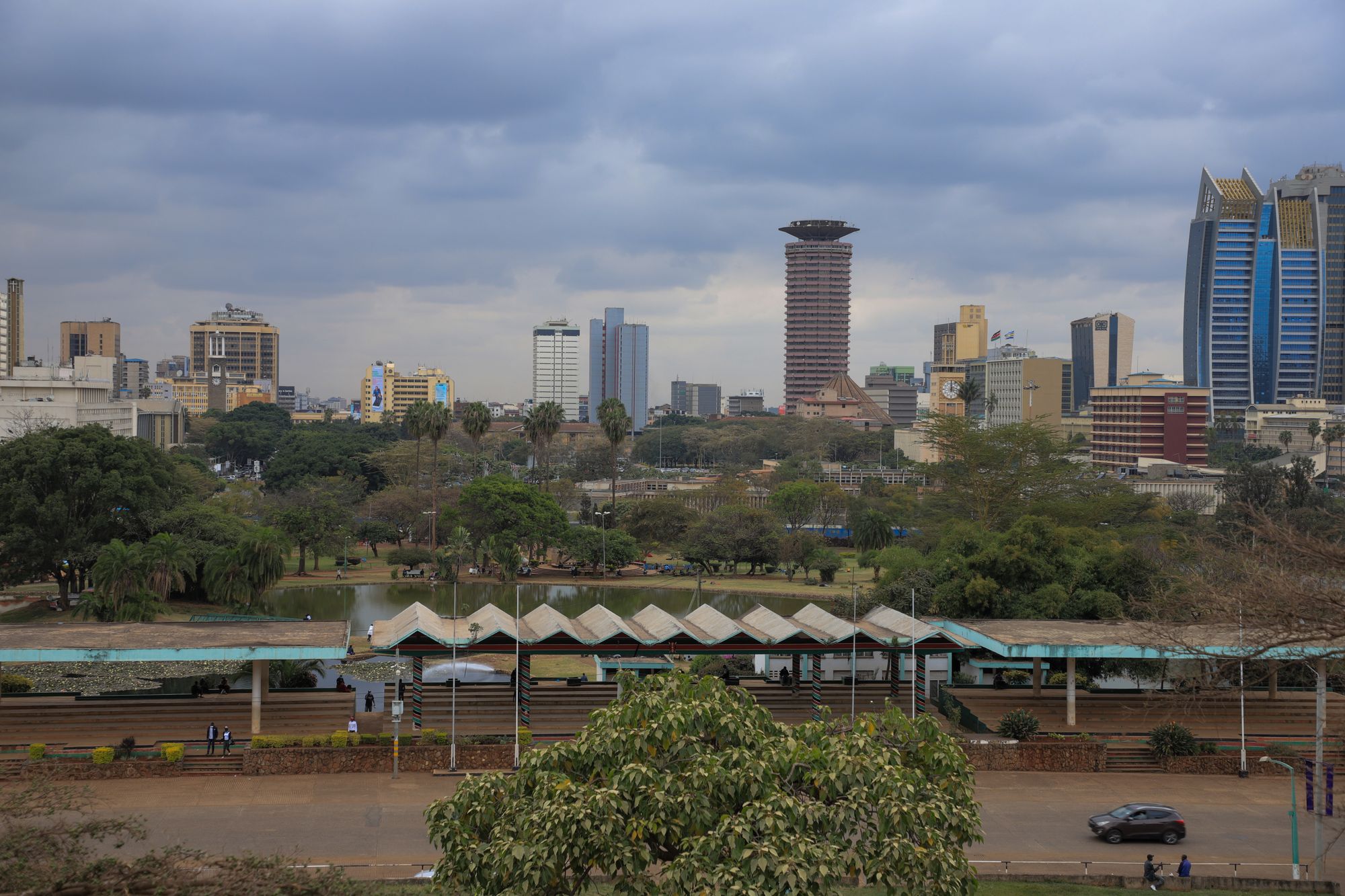
The reason to say this plainly is that the exceptions are not random. They cluster on the edges, and they cluster where a road engineer rather than a surveyor had the last word. A grid survives contact with people on foot. It does not survive a six-lane highway, a flyover or a hill, and this district has all three arranged around its western and northern rims. Read the figure as a measurement of the city as drawn. Then read the next section before you trust it as a measurement of the city as walked.
So the distances on this site are a tool with a known margin, and the margin is small in the middle and large at the edges. That is a more useful thing than a figure that pretends to be exact everywhere. Use the number to choose between two hotels on the avenue, to decide whether a museum detour fits into the day, to settle an argument about which end of the centre to start from. Do not use it to decide how long you will spend standing at a junction waiting for a gap that never comes.
02Three places the grid stops being a guide
Uhuru Highway is the first and the largest. Six lanes with no gaps run the full western length of the centre, and no straight line across it describes anything a person can do. The row above gives the crossing that does exist, which is the footbridge, and a footbridge is never on the direct line. Any figure that appears to point across the highway is measuring the width of the road, not the walk. Treat it as the distance to the highway rather than the distance to whatever stands on the far side, because those are different numbers and only one of them is walkable.
The Globe flyover is the second. Roads meet at the roundabout from every direction, and the flyover carries the through traffic above a junction that was already awkward on foot. The crossings exist, but they serve the traffic signal cycle rather than the shortest path, so a route that looks like a few minutes on the map becomes a walk around the outside of an interchange. Let the figure be the distance to the roundabout, not through it, and expect the last stretch north to be the slowest part of the walk.
Museum Hill is the third and the quietest of the three. The land rises beyond the roundabout, and the pavement takes the long way round rather than the short one: the road is fast, the crossing points are indirect, and the obvious line is not the one with a footway on it. The distance to the National Museum is therefore honest as a measurement of how far the museum is and dishonest as a measurement of how long it takes to arrive at its gate. Budget the extra as walking, not as waiting, and the arithmetic holds.
Inside the grid the figure does what it claims. Between the avenue and the market streets, between the bank towers and the basilica, the line and the route are close enough that the difference is not worth planning around. That is the useful contrast: a page that told you the straight line is always wrong would be as unhelpful as one that told you it is always right. The grid is fair, the edges are not, and knowing which one you are standing in is the whole skill. Elsewhere, only a route will do.
Uhuru Highway, west
Six lanes with no signalled gap along the whole western edge of the grid. The direct line to Uhuru Park runs straight across it, and the footbridges are the only sensible crossing.
The Globe flyover
The northern hinge of the centre, where the roads north and up Museum Hill meet. Junctions are built for vehicles, so the shortest line on a map is not a route on foot.
Museum Hill pavement
The road rises fast and the pedestrian route doubles back to reach the crossings. Follow the pavement even where it is longer than the line suggests.
Inside the grid
Between the avenue and the market streets the blocks are regular, the crossings are signalled and the direct line is a fair guide to the walk.
03What these figures cannot tell you
The distances and walking times on this site are direct lines computed from published coordinates at a steady pace on flat ground. They are not routes. No crossing, no blocked pavement, no slope, no queue at a gate and no roadworks are counted. A walk inside the grid usually comes close to the line. A walk to the parks, the flyover or Museum Hill will not. The line is a measurement of separation. It has no opinion about what stands between two points, and in this district plenty does.
The biggest omission is the crossing. A figure that treats a six-lane highway as flat ground is describing a piece of geometry rather than a piece of city, and the gap between the two is exactly where a walk goes wrong. The same applies to a flyover, to a junction built for vehicles, and to any gate where a queue forms at a particular time of day. Add the footbridge, add the signal cycle, add the pavement that runs the long way round the hill, and the honest figure is longer than the printed one.
This page is compiled from published information and the site's own checks rather than from a visit. Nothing here was measured on the ground by anyone writing it, and no writer has stood at any of these junctions. Opening arrangements and anything that moves week to week are not printed here, because a page cannot keep them current and a stale hour is worse than no hour. Where a figure will not settle your question, treat that as a signal to ask at the desk, at the gate or at the hotel, on the day you are going.
A number also cannot tell you whether a walk is worth making. Distance says nothing about shade, about how much of the route is on the sunny side, about whether the pavements are wide enough to walk three abreast, about whether there is anywhere to stop on the way. Those are judgements, and they belong to the reader standing on the pavement with the light going, not to a coordinate pair. The figure tells you how far apart two places are. It does not tell you what the walk between them is like, and those are different questions.
- Treat every distance on this site as a direct line from coordinates, not as a route you can walk without turning.
- Cross Uhuru Highway by the footbridges; six lanes with no gaps is not a crossing at any hour.
- Around the Globe roundabout and Museum Hill, follow the crossings rather than the shortest line, even where it doubles the distance.
- Times of day and opening arrangements are set by operators and move, so check them before setting out rather than trusting any page.
What these figures are not
The distances and walking times on this site are direct lines computed from published coordinates at a steady pace on flat ground. They are not routes. No crossing, no blocked pavement, no slope, no queue at a gate and no roadworks are counted. A walk inside the grid usually comes close to the line. A walk to the parks, the flyover or Museum Hill will not.
04How to use the distances
Read every figure on this site as a lower bound rather than an estimate. That is the single habit that makes the numbers useful: inside the grid the true walk will come in very close to the line, and at the parks, the flyover and Museum Hill the true walk will be longer, sometimes much longer. If a plan works with the figure unadjusted, it will work. If a plan only just fits, adjust it before you set out, not halfway there with the light going.
Use the figures for the decisions they are actually good at. Choosing between two addresses on Kenyatta Avenue. Deciding whether a museum detour fits into an afternoon. Working out which end of the centre to begin from. Ranking three errands in the same quarter. Those are the questions a direct line answers well, and they are most of the questions a visitor asks before leaving a hotel room. What the line cannot do is tell you how long the last stretch to a gate will take, and no page should pretend otherwise.
For the three edges, plan in words rather than in minutes. Cross Uhuru Highway by a footbridge, not at grade, at any hour of the day. Around the Globe roundabout and up Museum Hill, follow the crossings and the footway, even where they double the line. If you are going to the museum, allow more than the figure suggests and treat the surplus as part of the visit. If you are going to the parks, go in the last hours of daylight, because the gates close at dusk and the walk back is not one to make after dark.
Above all, go and look before you commit. The grid is legible from the pavement in a way it is not from a map, and a few minutes spent finding the crossing is never wasted. Where a figure will not settle the question, ask: at the hotel desk, at the gate, at whoever is standing beside you. The number gets you to the right part of the city. The walking, and the judgement about which line to take across it, remains yours to make on the day.
Where this page comes from
Desk research, not fieldwork. Nobody writing this stood on the corner with a stopwatch, and a page that implied otherwise would be the least trustworthy thing on the site. The specifics above came from here:
- Distances and walking minutes: computed from published coordinates, direct line at 4.8 km/h.
- Distances: computed from published coordinates, direct line from Kenyatta Avenue at Moi Avenue.
- Uhuru Park: Nairobi City County park information and the published record of the 1989 campaign.
Opening hours, ticketing and market days change. No hotel or operator pays to appear here.
05Questions
Can I walk from Kenyatta Avenue to Uhuru Park?+
The direct line is short enough to look easy on a map. The walk itself has to cross Uhuru Highway, which is six lanes without a signalled gap. Use a footbridge. It is the only sensible crossing and the route is longer than the number suggests.
Are the walking times on this site reliable?+
They are direct-line estimates at a steady pace on flat ground, taken from published coordinates. Inside the regular grid they are a fair guide. Across the highway, the flyover junctions or up Museum Hill, expect the real walk to run longer, sometimes much longer.
How do I get to the National Museum from the centre?+
The museum sits above the Ngara edge, and the direct line draws a straight route up the hill. The pedestrian route does not run straight: the road is fast and the crossings are indirect. Follow the pavement and the signalled crossings rather than the shortest line on a map.
Is it safe to walk these edges after dark?+
Uhuru Highway and the Globe roundabout are built for vehicles and read as traffic corridors once the light goes. Crossings that are awkward in daylight are worse in the dark. Travel by car on the western and northern edges after sunset.