01A plan that still runs the centre
The colonial township laid the grid, zoned it, and left the street pattern the centre still uses. That is the whole argument of this page. The town was set out beside the railway, with streets running north from the station and crossing streets laid across them, and the zoning attached to those blocks decided what each quarter became. The market streets kept their narrow frontages, the avenue kept its width, and the busy grid carried the traffic between them. None of that was accidental.
Why give the plan a page? Because the grid is the one piece of the city that has outlasted every change of use on it. Banks have come and gone along the avenue, shopfronts have been subdivided in the busy grid, but the lines themselves have not moved. If you understand which streets the surveyors drew wide and which they drew narrow, you understand why the market quarter feels enclosed and the avenue feels open, without needing a guide to explain it.
The plan also explains the district's stubbornness. A colonial township zoned its blocks by trade, and those blocks kept their trades far longer than the buildings that first housed them kept their tenants. Cloth stayed in the market streets for a century. Head offices stayed on the avenue until they began to drift west. The zoning is not a historical curiosity: it is live. What you see on a weekday morning is still, in outline, the map that was drawn when the railway camp was a swamp.
This page is not a history of Nairobi and does not pretend to be one. It is about a single district, the commercial and historic core between Uhuru Highway, the railway and Ngara, and about the one inherited thing that still organises it. The plan shaped the market streets, the busy grid and the avenue, and the sections below take each in turn. Where the record is thin, the page says so rather than filling the gap.
02What each quarter of the grid became
The market quarter is the clearest survival. Biashara Street was Bazaar Street, the retail heart of the Indian commercial town that grew beside the railway camp, and it is the only part of the centre where the shops are still one family wide. Cloth, haberdashery and school outfitters trade in frontages the width of a single business, with tailors upstairs. Muindi Mbingu Street runs north beside it carrying the flower sellers, and Banda Street holds Jamia Mosque at one end and the McMillan Memorial Library at the other. The zoning put retail here and it stayed.
The busy grid took the traffic. Moi Avenue and Tom Mboya Street run parallel through the eastern half and between them carry what is probably the heaviest pedestrian traffic in the country. Shops at street level, offices stacked above, stages at both ends, and a pavement that does not thin out between morning and night. The plan did not design that crowds would come in these numbers, but it did put the wide, connected, crossable streets here, and the crowds followed the geometry. The National Archives sits in the middle of it, in a former banking hall.
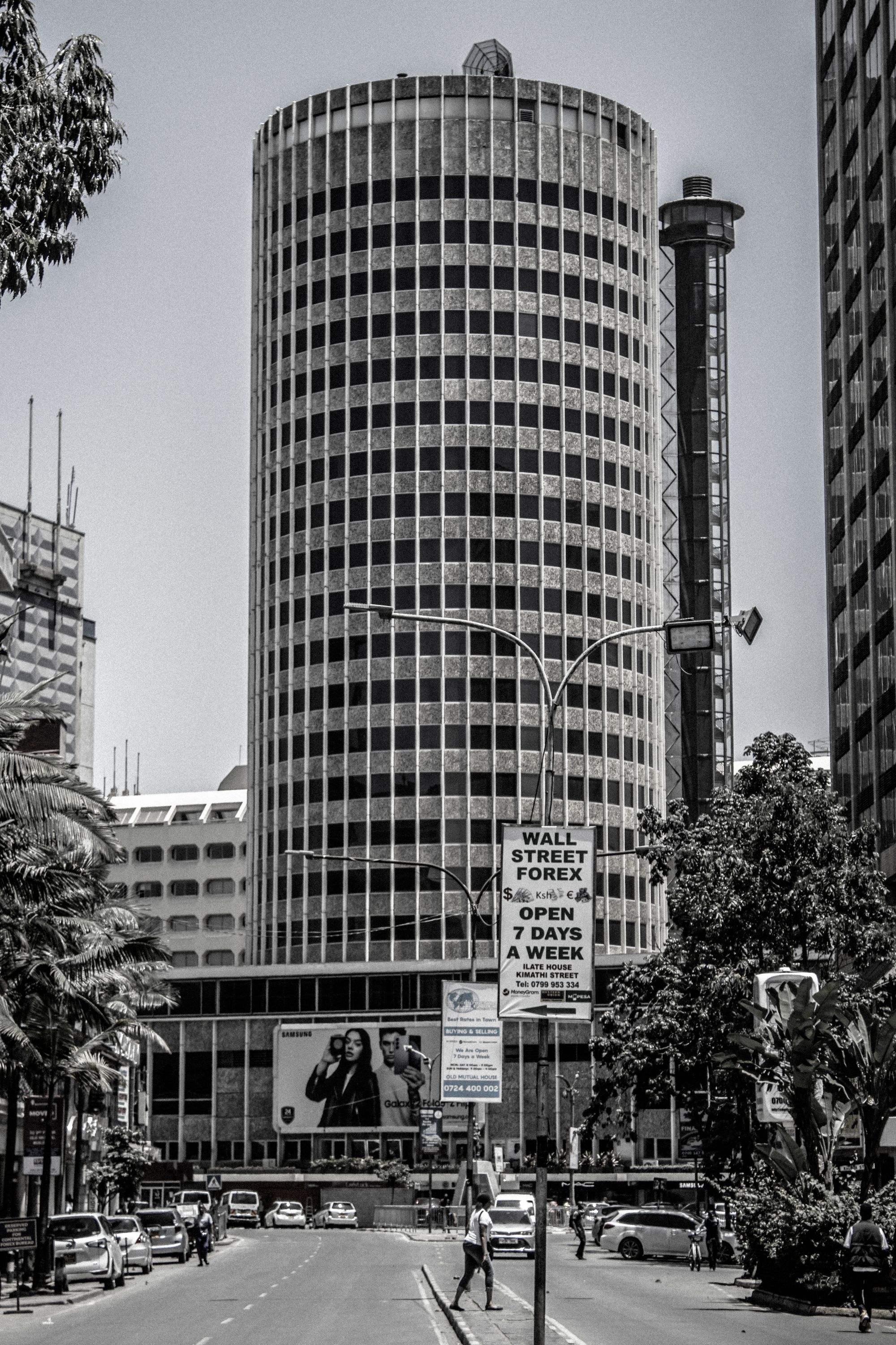
The spine is the avenue. It was laid out wide enough to turn a full ox wagon in, which is why the financial centre of Kenya has the most generous pavements in the region. Six lanes, a planted median, banks on both sides, and the jacarandas that give it its photograph for a few weeks each year. The width is the one piece of nineteenth century planning that still shapes how the centre feels. Stand anywhere on the avenue and the rest of the grid arranges itself around you.
Where the pattern shows is at the junctions. The short cross streets between the market quarter and the busy grid, Kimathi Lane and the Muindi Mbingu crossings among them, are quicker on foot than any vehicle and connect two quarters that read completely differently. Kimathi Street, one block north of the avenue, is the most pleasant short walk in the centre. The transitions are abrupt, which is the point: the zoning drew hard edges between retail, traffic and finance, and those edges are still where the character of the district changes.
The market quarter
Biashara Street, Muindi Mbingu Street and the City Market hall. Cloth, produce and curios in narrow single-family shopfronts, with Jamia Mosque closing the block to the north.
The busy grid
Moi Avenue and Tom Mboya Street, side by side through the eastern half. Shops at street level, offices above, and the heaviest pedestrian traffic the CBD carries.
The spine
Kenyatta Avenue, laid out wide and still the financial address of the centre. Bank halls, the old Stanley corner and the deepest pavements in the grid.
Where the pattern shows
The grid gives each quarter a different trade and a different hour. Walk the market streets before the halls shut, the busy grid through the day, and the avenue while the banks hold weekday hours.
03What this page cannot date or verify
The township's survey and the years each street took its present form are not reliably dated here, and this page will not invent one. Published city and archives histories cover street naming and the colonial grid, and those records move and are corrected over time. Read the streets themselves as evidence of zoning, and treat any single founding year attached to the grid as something to check rather than repeat. That is the honest position, and it is the same position the callout on this page takes.
The sourcing caveat is simple and it applies to every paragraph above. This page is compiled from published information and the site's own checks rather than from a visit. Nobody writing it has walked these streets, timed a crossing or stood in a market hall. Opening arrangements and anything that moves week to week are not printed here, which means no trading hours, no market days and no clock times, because those are set by operators and shift with the seasons, the enforcement and the tenant.
That restraint has consequences you should know about. A page that will not print an hour is less useful on the morning you set out, and a page that will not name a founding year is less satisfying than one that does. The trade is deliberate. A wrong hour sends you across the centre for nothing, and an invented date gets repeated for decades. Where a time matters, check with the operator on the day. Where a date matters, check the archives rather than a travel page, including this one.
What remains solid is the shape. The grid, the quarters and the relative width of the streets are visible without any date attached to them, and the zoning is legible in what trades where. Use the pattern as the reliable part and treat every specific claim about when it was drawn as unverified. The bullets below set out what that means in practice, quarter by quarter, and the practical section that follows says what to do with the pattern on foot.
- Treat the zoning as a map, not a schedule: each quarter's trade still sets its own trading hours, and the operators publish the current ones.
- Walk the market quarter in daylight, since Biashara Street and the City Market hall are daytime addresses and the shutters come down together.
- Expect the busy grid to shift block by block as hawker enforcement moves, so ask locally before assuming a street is clear or crowded.
- Do not read a year off a building and treat it as a founding date; the naming and rebuilding of the grid is documented separately from the plan itself.
What this page cannot date
The township's survey and the years each street took its present form are not reliably dated here, and this page will not invent one. Published city and archives histories cover street naming and the colonial grid, and those records move and are corrected over time. Read the streets themselves as evidence of zoning, and treat any single founding year attached to the grid as something to check rather than repeat.
04Using the street pattern on foot
Use the zoning as an orientation device, not an itinerary. Start at Kenyatta Avenue at Moi Avenue and the whole grid is legible from there: the market quarter a short walk north, the busy grid at the east end, City Square and the convention centre tower to the south, Uhuru Park at the west. That one junction is the best place in the district to work out where everything else sits. This site would send a first visit to the avenue for exactly that reason.
Then choose an order by character rather than by distance. The market quarter is a daytime address: narrow, shaded, the shops one family wide, and the halls shutting in the late afternoon with the streets emptying behind them. The busy grid is loudest through the working day and the pavements thin fast after the commute. The avenue empties with the offices. Walk the market quarter and the grid in daylight, and do not plan on any of the three after dark.
Between the quarters, use the lanes. The short cross streets linking the market quarter to the busy grid move faster on foot than anything on wheels, at any hour, and they let you step between two completely different streetscapes in a couple of minutes. The avenue's pavements are wide enough for three abreast; Biashara Street's are not. Adjust your pace and your expectations at the junction rather than carrying one quarter's habits into the next.
Finally, read the streets as evidence. The narrow frontages tell you what the zoning intended; the widened avenue tells you what the surveyors expected to move along it. You do not need a guide to see that, and you do not need a founding year. If the pattern is the part of the story that holds, it is also the part you can check with your own eyes in an hour, which is more than can be said for most of what gets written about this centre.
Where this page comes from
Desk research, not fieldwork. Nobody writing this stood on the corner with a stopwatch, and a page that implied otherwise would be the least trustworthy thing on the site. The specifics above came from here:
- Street naming and the colonial grid: Nairobi City County and National Archives published histories.
- City Market and McMillan Library: Nairobi City County heritage listings and the library trust’s restoration notices.
- Distances: computed from published coordinates, direct line from Kenyatta Avenue at Moi Avenue.
Opening hours, ticketing and market days change. No hotel or operator pays to appear here.
05Questions
Can I see the old zoning without a guide?+
Yes. The grid is legible on foot: retail narrows into Biashara Street and the market halls, offices and banks line Kenyatta Avenue, and the busiest pavements run east along Moi Avenue and Tom Mboya Street. Start at Kenyatta Avenue at Moi Avenue and let the trade of each block tell you which quarter you are in.
Which quarter should a first walk cover?+
Start on Kenyatta Avenue for orientation, then take Kimathi Street north and the market streets on foot. That route passes the bank halls, the old Stanley corner and the City Market block in a short distance. The busy grid is worth adding once the layout is clear.
Are there opening hours for the market streets?+
They are set by the traders and the market management and move with season and enforcement, so this page prints none. The halls and shops trade through the day and empty in the late afternoon. Check the market operators and the individual businesses on the day you go.
Is the colonial street pattern still the real shape of the centre?+
The grid survives in the streets themselves, which is why the quarters still read the way they do. What has changed is the trade inside the blocks, as head offices drift west and ground floors refill. The plan is the constant; the tenancy is not.