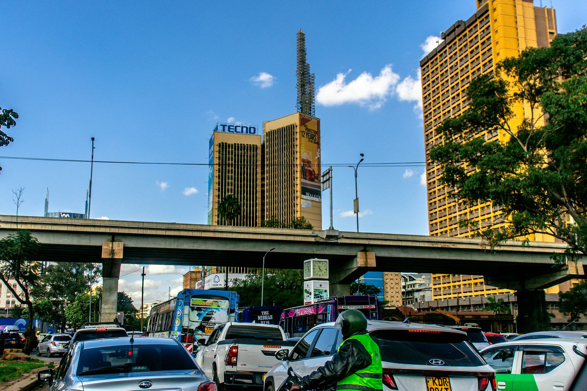
01The street named for a man shot in 1969
Tom Mboya Street runs one block east of Moi Avenue through the eastern half of the central business district. It carries the name of a trade unionist and minister who was shot on Government Road in 1969, and the street itself was renamed in his memory. That is the public record, and it is enough to explain why the name appears on a street sign in the middle of the busiest pedestrian quarter in the country. The renaming turned a commercial thoroughfare into a daily reminder of a political killing that reshaped the city's sense of itself.
What the street became is a plainer thing. Ground floors are subdivided into phone shops, fabric traders, kiosks and stairwell arcades. Offices stack above. The pavement does not thin out between early morning and after the offices close. This is not a memorial in any formal sense. There is no monument on the block. The memorial is the traffic: tens of thousands of people using a street that carries a name most of them know, in a city that has not always been careful with the memory of the people it names streets after.
Moi Avenue, the wider parallel street to the west, was Government Road before it took its current name, and it carried the colonial administration up from the station. Tom Mboya Street carries no such administrative history. It is retail and transport and noise, and the naming sits on top of that rather than replacing it. The two streets together take more pedestrians than any other pair in Kenya, and almost none of that traffic is going anywhere in particular. People shop, change buses, eat lunch, preach and meet on these blocks.
The street named for Mboya is therefore worth a page not because of the assassination but because of what the city did next. It kept the name and kept using the street. The Kenya National Archives sits nearby in the old Bank of India building at the Hilton corner, and the whole quarter reads as a working centre that has absorbed its own history without making a display of it. For a visitor, that is the useful fact: this is not a heritage street. It is a street with a heritage in its name.
02What the two streets carry, block by block
The row list on this page names the four stretches that matter, and the order is the order to walk them. Moi Avenue is the wider of the two and runs from the railway end north to the Globe. The Archives sits midway at the Hilton corner, and hawker pressure is heaviest on the southern half. Tom Mboya Street, one block east and narrower, carries cinemas turned churches, fabric shops and the loudest sound system per metre in the centre. Both streets are shops at street level with offices above, and both have matatu stages at their ends.
The crossings are the part that visitors underuse. Kimathi Lane and Muindi Mbingu link the busy grid to the market quarter, and they are quicker on foot than any vehicle at any hour. Ronald Ngala Street marks the northern boundary of this quarter and the transition into the River Road side. That street is busy and functional, and the advice on it is different: cross it in daylight only. The four together make a loop that can be walked in a single stretch without ever needing a car, which is the point of the grid.
Block by block, the character shifts. The southern half of Moi Avenue near the railway end is the most pressured pavement, with hawkers and phone shops and a bus every few seconds. The middle section, around the Archives and the Hilton roundabout, is where the crowd thins slightly and the buildings get taller and older. Tom Mboya Street is denser and louder throughout. The short cross streets are quieter and faster. Ronald Ngala is the edge, and the edge behaves differently from the middle.
What the two streets carry, then, is not one thing. They carry retail, transport, lunch, preaching and errands, and they carry them all at once for most of the day. The useful way to read the quarter is as a single system with four named parts, not as two famous streets with two lesser ones attached. The row list is the map. The walking is the substance.
Moi Avenue
The wider of the pair, running north from the railway end. The National Archives sits mid-way at the Hilton corner, and hawker pressure is heaviest along the southern half.
Tom Mboya Street
One block east and narrower: cinemas turned churches, fabric shops, and the loudest sound system per metre in the centre.
The crossings
Kimathi Lane and Muindi Mbingu link the busy grid to the market quarter. On foot they are quicker than any vehicle at any hour.
Ronald Ngala Street
The northern boundary of this quarter and the transition into the River Road side. Functional, busy, and best crossed in daylight.
03What this page cannot tell you
This page is compiled from published information and the site's own checks, not from a visit. Nobody writing it has walked these pavements. That matters most for the things that move: opening arrangements, hawker enforcement, which blocks feel crowded in a given month, and the photography rules at the National Archives, which are posted at the desk and enforced. Opening hours and anything that moves week to week are not printed here, because they belong to the operator and change without notice. Check at the desk on the day.
The bullet list on this page is the practical half, and it is deliberately blunt. Do the walking in daylight. Keep a phone in a pocket rather than in a hand, because the pavement thins fast after the commute. Photograph from doorways and shop fronts rather than mid-pavement, and keep the camera strap on your wrist. Do not try to drive either street in the middle of the day, since vehicles move slower than pedestrians for most of it. If you want a quiet room on these blocks, ask for a high floor or a courtyard room.
What this page cannot tell you is also what not to expect. There is no single address for Tom Mboya Street, no one building that represents it, and no formal memorial to the man it is named for on the blocks themselves. Street trade moves around from month to month as enforcement shifts, which changes how crowded a given block feels, though the street itself does not change. The Archives keeps its own hours. The matatu stages at both ends have no signage and a strict internal order, and that order is not written down anywhere this page can print.
Treat the caveat as part of the guide rather than a disclaimer. The city centre is a working place, and the parts of it that change are exactly the parts a visitor notices first. The parts that do not change are the grid, the names, the pavement and the traffic. Plan around the second and check the first on the day, at the desk or against the institution's own published information.
- Do the walking in daylight and keep a phone in a pocket rather than in a hand, because the pavement thins fast after the commute.
- Photograph from doorways and shop fronts rather than mid-pavement, and keep the camera strap on your wrist.
- Do not try to drive either street in the middle of the day, since vehicles move slower than pedestrians for most of it.
- If you want a quiet room on these blocks, ask for a high floor or a courtyard room, because street noise is the common complaint.
What this page cannot tell you
Opening hours, entry arrangements and photography rules at the National Archives are set by the institution and move. This page prints no hour and no price of any kind, in any currency, because those belong to the operator and change without notice. Check at the desk, or against the institution's own published information, on the day.
04How to use the street on foot
Walk it. That is the whole method on these two streets. Vehicles move slower than pedestrians for most of the day, so a car is a hindrance rather than a help. Start from Kenyatta Avenue at Moi Avenue, which is the grid origin, and take Moi Avenue north first, because it is wider and easier to read. Then cut across to Tom Mboya Street and come back south. The four rows on this page are the shape of that loop. The whole thing is a short walk, and the useful part is not distance but attention.
Go in daylight and go with one pocket. Nothing in your hands is the rule that covers most of the risk: phone away, camera strap on, bag in front. The crowd is not the danger; being distracted inside it is. If you want the Archives, treat it as a single stop of about an hour and check the photography rules at the desk before you start shooting. That is the one interior on these blocks that rewards a slower pace, and it sits at the Moi Avenue end in the old Bank of India building.
For food, use the working kitchens of the quarter rather than looking for a view. The blocks feed tens of thousands of commuters at lunch, which means fast, hot food cooked in volume, and it is the best value in the centre. The older retail streets here and in the market quarter next door carry a long Indian commercial history, and the lunch counters that come with it are still in business. Eat where the queue is local. Then walk it off on the crossings, which are quicker on foot than any vehicle at any hour.
After dark, change the plan. The pavements thin out fast after the commute and the character changes with them. This is where the general advice stops: take a car after dark, or stay on the lit blocks closest to your hotel. If you are sleeping on these streets, ask for a high floor or a courtyard room, because street noise is the common complaint in the reviews. That is the honest verdict. Use the street on foot in daylight, use it for errands and lunch, and use something else after dark.
Where this page comes from
Desk research, not fieldwork. Nobody writing this stood on the corner with a stopwatch, and a page that implied otherwise would be the least trustworthy thing on the site. The specifics above came from here:
- Street naming and the colonial grid: Nairobi City County and National Archives published histories.
- Tom Mboya: the public record of 1969 and the street naming that followed.
- Distances: computed from published coordinates, direct line from Kenyatta Avenue at Moi Avenue.
Opening hours, ticketing and market days change. No hotel or operator pays to appear here.
05Questions
Why is the street named for Tom Mboya?+
Tom Mboya was a trade unionist and government minister assassinated on Government Road in 1969. The parallel street to the east was later named for him. Moi Avenue, the wider of the two, was Government Road under the colonial administration.
Can I visit the Kenya National Archives on these streets?+
Yes, it occupies the old Bank of India building at the Hilton corner and is a ticketed institution. Photography rules are posted at the desk and enforced. Hours and ticketing arrangements are set by the institution, so check on the day rather than relying on any list.
Is it safe to walk Moi Avenue and Tom Mboya Street?+
In daylight it is busy and manageable, with the crowd itself rarely the problem. The caution is distraction: keep phones out of hands and bags closed. The pavements thin quickly after the evening commute, and after dark a car is the better choice.
How do I get to Tom Mboya Street?+
On foot from anywhere in the grid. Kenyatta Avenue at Moi Avenue is the usual starting point, a direct line of 0.27 km, roughly 4 min walking. Vehicles move slower than pedestrians here for most of the day, so walking is the practical option.