01Why the deck earns a page
A street-level walk through the CBD shows you one frontage at a time. The KICC rooftop deck lifts you above the entire grid and lets you see how the pieces fit: the civic block, the park edge, the ridge, the railway land. That single view does more explanatory work than an hour on the pavement, and it is the reason this page exists alongside the things-to-do page for the tower itself. The deck is not an attraction in the ordinary sense. It is an instrument for reading the city, and it repays a deliberate visit rather than a quick look between other stops.
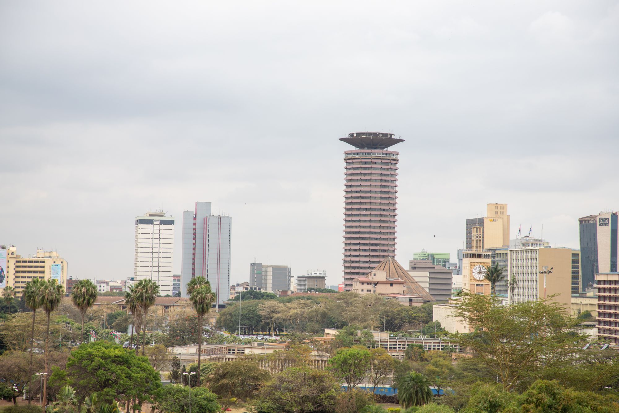
From the deck, the CBD grid stops being a set of separate streets and becomes a diagram. You can trace the line of Kenyatta Avenue from Moi Avenue to the railway, see how Parliament Road runs along the western side towards Uhuru Highway, and understand why Harambee Avenue feels like a corridor of ministries rather than a shopping street. The view is especially good for the civic block, where the paving, flags, cathedral and mausoleum were placed to be seen from one spot. On the ground those relationships are easy to miss because security fencing and traffic interrupt the sightlines. From the roof they are obvious.
The deck also gives you the district's scale. Twenty-eight storeys up, the bank towers and the older commercial blocks fall into a pattern that street level hides. You can see where the ridge runs, how the railway land cuts a broad gap through the south, and how the park on the western edge is not just a border but a deliberate opening in the fabric. None of this is information you can get from a guidebook paragraph. It is read directly from the view, which is why the deck is worth a page of its own rather than a line in a list of nearby attractions.
Most first-time visitors to the CBD treat the deck as a photo opportunity and little else. That is a waste. The deck repays half an hour of looking rather than a minute of snapping, and it is the best way to orient yourself before or after walking the streets. The ticket arrangements and access details are handled by the operator, and this page does not print them. What this page does is explain what the view shows and why it matters. Read it before you go up, and the grid below will make more sense when you come down.
02What the view actually lays out
The row list below sets out the four things the deck explains better than any street-level walk. Each is a piece of the district's structure, and each is at least partly invisible from the pavement. The civic block, the park edge, the ridge and the towers, and the railway land are the four elements that make the CBD legible from above. None of them is a secret, but their arrangement is the point. What follows is not a repetition of the row list but the reasoning behind it: why these four, and what each one shows you that a map cannot.
Start with the civic block. From the deck you can see that Parliament, the Supreme Court, City Hall, the Holy Family Basilica and the Kenyatta mausoleum are arranged around open paving that is closed to through traffic. That is not an accident of history; it was planned as a set piece. From street level the fencing and the security checks break the block into separate errands. From above the deliberate geometry is clear: the buildings face each other across a single outdoor room, and the flags and paving mark the centre. This is the one part of the grid that was designed rather than allowed to happen, and the deck is where that design reads.
The park edge is the second thing the view clarifies. Uhuru Park and Central Park sit along the western boundary, and from the deck you can see how they open the grid to the sky and give the towers a base of green. The boating lake, the paths and Freedom Corner are all visible in relation to the CBD rather than as a separate destination. The park is not simply a border; it is the reason the skyline photographs as well as it does, because the lawns clear the foreground and let the buildings stand against the sky. That relationship is hard to see from inside the park itself, where the trees and the lake block the long view.
The ridge and the towers are the third item, and the railway land is the fourth. From the deck you can trace how the land rises gently towards the west and how the office towers cluster along that ridge, while the railway corridor cuts a wide, low gap across the southern edge. The railway explains why certain streets dead-end and why the grid has the shape it does. None of this is a walking route; it is the underlying structure of the district. Seeing it from above turns a confusing set of streets into a coherent pattern. That is the deck's real value, and it is why the view is worth more than the photograph it produces.
The civic block
From above, the arrangement reads: Parliament, the Supreme Court, City Hall and the basilica placed around open paving closed to through traffic. No street-level walk shows this as clearly.
The park edge
The western edge falls away towards Uhuru Highway, and the parks sit along it. The deck shows the boundary between the grid and the green, which is hard to read at ground level.
The ridge and the towers
Bank towers and hotel blocks run north along the ridge. The deck gives their order and spacing, and shows how the convention centre's cylinder sits among them.
The railway land
Behind the grid, the railway yards and the station roof sit lower than the streets around them. The deck is the one place in the quarter where this register is visible as a whole.
03What the view cannot tell you
The deck gives you the arrangement of the district, but it cannot tell you how the district works. Opening hours, ticketing, market days and anything that moves week to week are not visible from twenty-eight storeys up, and this page does not print them. This page is compiled from published information and the site's own checks rather than from a visit, so it cannot vouch for conditions on the day. If you need a specific time, ask at the ground floor desk or check the operator's own information. What follows is a short list of the practical things the view cannot show, and a caveat about what this page can and cannot say.
The bullet list below covers the main points. Buy your ticket at the ground floor desk, and bring identification; access arrangements are set by the operator and can change. Check the deck's opening hours and weather closures on the day, because state events and bad weather close it without notice. Morning light is better for the view north and west, though this page prints no clock time. And keep the camera out on the deck, but put it away along Harambee Avenue, where photographing government buildings is not always welcome. These are not minor details; they determine whether the visit works at all. The view itself is the easy part.
What this page cannot say is equally important. No opening hour is printed here. The deck's hours, ticketing arrangements and weather closures are set by the operator and move, so the desk and the operator's own information are the only current source. Anyone who needs a specific time should ask there rather than rely on a page like this. The same applies to state events that close the rooftop without notice. The honest caveat is that this page is a guide to what the view shows, not a live timetable. Treat it as orientation, not as a schedule, and you will not be caught out by a closed deck or a missed window.
The view is also limited in what it can explain about the ground. From above, the civic block looks orderly; at street level, security checks and traffic make it feel fragmented. The park looks like a green margin from the deck; on foot it is a set of paths, gates and closing times. The deck cannot tell you which pavement is busy, which crossing needs a footbridge, or where the hawkers are. It shows structure, not texture. For texture, you need the street-level pages, and for times you need the operator. This page's job is to prepare you for what the view lays out, and to be clear about the limits of a rooftop.
- Buy the ticket at the ground floor desk and bring identification; access arrangements are set by the operator and can change.
- Check the deck's opening hours and weather closures on the day, because state events and bad weather close it without notice.
- Go up in the morning if light matters to you; the view north and west reads better earlier, and this page prints no clock time.
- Keep the camera out on the deck, but put it away along Harambee Avenue, where photographing government buildings is not always welcome.
What this page cannot say
No opening hour is printed here. The deck's hours, ticketing arrangements and weather closures are set by the operator and move, so the desk and the operator's own information are the only current source. Anyone who needs a specific time should ask there rather than rely on a page like this. The same applies to state events that close the rooftop without notice.
04How to use the deck properly
The best way to use the deck is to treat it as a two-part exercise: look first, then walk. Go up before you explore the streets, and use the view to build a mental map. Identify the civic block, the line of Kenyatta Avenue, the park on the western edge and the railway land to the south. Then come down and walk the grid with that map in your head. The deck is not a destination in itself; it is a tool for reading the district. A first visit that skips it will still see the buildings, but it will miss the logic that connects them. The reverse order works too: walk first, then go up to make sense of what you saw.
Timing matters more than most visitors expect. The deck's opening hours and weather closures are set by the operator and change, so check on the day rather than relying on any printed time. Morning light generally reads better for the view north and west, though this page prints no clock time. If a state event is on, the rooftop can close without notice. The practical approach is to ask at the ground floor desk when you arrive, and to have a fallback plan if the deck is shut. The rest of the CBD does not depend on the rooftop being open, and the civic block, the basilica and the park are all worth the walk regardless.
Photography is expected on the deck and the light is the reason. Bring a camera and use it freely up there, but change your habits on the way down. Along Harambee Avenue and around Parliament, photographing government buildings is not always welcome. Ask first, or keep the camera away. The same caution applies near the ministries and the mausoleum. The deck is the safe vantage point; the pavement is not. If you want the skyline shot, take it from the rooftop or from the park's eastern paths, where the towers line up behind the water. Do not assume that a public street is a public viewpoint.
The final piece of advice is to give the deck enough time. It is not a five-minute stop. Half an hour of looking will teach you more about the CBD's layout than a full morning of walking without orientation. Use the row list and the bullet list on this page as a checklist of what to look for and what to check, and leave the timings to the operator. The district below is a planned civic block, a park edge, a ridge of towers and a railway corridor. The deck is where that structure becomes visible. Go up, look properly, then walk the grid with the view in your head. That is how the deck earns its place.
Where this page comes from
Desk research, not fieldwork. Nobody writing this stood on the corner with a stopwatch, and a page that implied otherwise would be the least trustworthy thing on the site. The specifics above came from here:
- Building history and public access: Kenyatta International Convention Centre visitor information.
- Distances and walking minutes: computed from published coordinates, direct line at 4.8 km/h.
- Architectural attribution: published architectural records for the 1973 building.
Opening hours, ticketing and market days change. No hotel or operator pays to appear here.
05Questions
Can I go up the tower without booking?+
The deck is reached by a ticket bought at the ground floor desk, and identification is asked for. Access arrangements are set by the operator and can change, so the desk is the place to confirm on the day. There is no need to treat this as a fixed appointment, but check before making the trip.
What can I see from the deck that I cannot see from the street?+
The layout of the civic block: Parliament, the Supreme Court, City Hall and the basilica arranged around open paving. The western edge where the parks begin, and the railway land behind the grid, both read as whole pieces from above. Street level shows the parts, not the arrangement.
Is the rooftop open in bad weather?+
The deck closes in bad weather and for state events, and this page prints no hours for that reason. Check at the desk or with the operator's own information on the day. Morning light is better for the view north and west, but the weather decides whether the deck opens at all.
Can I take photographs at the civic buildings?+
On the deck, photography is expected. Around Parliament and along Harambee Avenue security is real, and photographing government buildings is not always welcome. Ask first, or keep the camera down. The rooftop is the safer place for a wide view of the district.